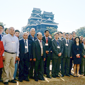
At the first ADRC International Meeting, held February 16 to 18, 1999, a
workshop entitled "The Use of Technology" was organized to discuss the
use of GIS and remote sensing for disaster management. The following conclusions
were reached:
*All member countries recognized the value of GIS and remote sensing, and their
advantages in information management.
*Future tasks include acquiring real-time satellite images, acquiring satellite
data at lower costs, technological support for introducing GIS and remote
sensing, and acquiring technologies for extracting disaster management
information.
Despite the high interest shown in GIS and remote sensing by the disaster
management authorities in each country, high costs and the necessary skills pose
as obstacles in the application of these technologies. Also pointed out were the
high costs required for the use of satellite and geographical data.
In order to resolve these problems, the ADRC developed VENTEN (Vehicle through
Electric Network of disasTer gEographical informatioN), Internet based
geographical information system on disaster management which can be accessed by
anyone, anywhere, using the rapidly growing Internet.
The goals in the development of VENTEN were to provide both a system and
data. This system can be used with a PC connected to the Internet and a World
Wide Web browser.
Various international organizations, etc. provide basic geographical information
such as topography and natural conditions. In order to browse and understand
this information, it is necessary to convert the data format according to the
GIS used. Thus in developing VENTEN, various geographical information was
gathered and converted to a format which can be used immediately on the VENTEN
system, and provided with the system.
Fig. 3-6-1-1 shows the positioning of VENTEN. On the left, are the
development and research organizations and organizations providing information
such as satellite data and aerial photograph service organizations, which
provide the primary data. In order to extract useful information for disaster
management from this primary data, numerous image processing and adjustments are
required, as are the means to send this information to the side handling the
actual disaster management work. Disaster reduction researchers can also browse,
analyze information, and add results to VENTEN. The VENTEN system has database
and analysis functions for disaster management remotely, and by serving as the
information transmission route to those working on disastermanagement, it
enables the use of disaster reduction remote sensing information in actual
activities, to reduce damage such as the preparing of disaster reduction plans
and support of rescue activities.

![]()
VENTEN system consists of Web server, GIS server and database server. Fig. 3-6-2-1 shows the information processing flow in VENTEN. Upon request from users, Web server specifies necessary information including what geographical data and what part of area are needed (more than one geographical data is possible to be specified), for GIS server. GIS server, if necessary, referring to the data server, abstracts the necessary part of area from the geographical data accumulated within itself, and then processes it to send to Web server in a form of a raster image data. Web server adds to it country selection menu, disaster geographical information selection menu, show/hide selection button for basic geographical data and button for changing scale and area to be displayed other than geographical data. Then it sends users information in hypertext format including the raster image data provided by GIS server.

There are a couple of systems for Internet based GIS. For example, one of them can be used by downloading an application program. Another system based on an image map only provides geographical information. VENTEN can be positioned in between those two systems in a system wise. In other words, users can process vector data on VENTEN, but obtain only raster data based on the vector data. Although it restricts users to obtain data, this system solves the problems of difference in response caused by different network environments and performance of client machine at the time of operation, and of property right for data. For Internet GIS, traffic load of network in sending data is problematic. However, since VENTEN only sends a fixed scale of image of 470 x 470 pixel to be displayed at center of VENTEN screen, it take server longer in calculation and difference in network environment between VENTEN and end users does not have significant impact in data sending. Most data processing is done by server machine and all the client machine should do is to display data it receives, so that difference of performance in various client machines does not have significant impact. It is easy to persuade many data providers to join in this system because vector data which is very close to the original information in its amount, is not given to users. The users will finally get only raster data, but user can process it as if they could process directly vector data.
VENTEN has GIS standard functions of "drawing map in any scale",
"buffering", "overlaying" and "searching by location
and attribute". Fig. 3-6-2-2 shows a buffer with abstracted results of
population of cities in the buffer. The buffer is set to 30 km with Osaka
International (Itami) airport as its center. The city names and their population
in that area are shown in another window. Likewise, VENTEN provides raster based
information to the end users, but the users can make various request to process
vector data on the server, enabling VENTEN to provide the advanced service more
than that of Internet base GIS with browsing as its main function.

VENTEN gathers data for the 22 member countries of the ADRC. Two types of information are collected; basic geographical information whose use is not restricted to disaster reduction, particularly topography and natural conditions, and disaster reduction geographical information on maps. Until now, the following information has been gathered:
1) Basic geographical information
National borders (region), water systems (line, region), railroads (line),
roads (line), airports (dot), position of cities (dot), city name (character
strings), population (number), shaded image based on sea level (raster image),
contour drawings of sea level (raster images) (Data source: DCW (Digital Chart
of the World), GRID, GTOPO30).
2) Disaster reduction geographical information
Flood areas during the 1998 Chang Jiang flooding, damage to homes around
Nishinomiya Station during the 1995 Great Hanshin-Awaji Earthquake, damage by
street number of town based on the household damage survey during the 1995 Great
Hanshin-Awaji Earthquake, active fault distribution drawing.
A menu on basic geographical information is provided at the bottom right of
the VENTEN screen, to enable the information to be displayed or turned off
anytime.
Fig. 3-6-3-2 shaded relief image based on water system and elevations of India and Bangladesh (Above) and shaded relief image on railroads, roads, and elevations of Sri Lanka (Below)

Fig. 3-6-3-3 Flood area, roads, railroads and drainage
As described in 3-6-1, Asian member countries are attempting to compile hazard maps applying GIS and drawing up evacuation routes, but the high cost of installing the GIS system, and the difficulties involved in acquiring knowledge and geographical information pose as obstacles in promoting these efforts. The VENTEN system has the potential to resolve these problems and promote use of the GIS system. Users are able to freely access the various geographical information accumulated in the VENTEN server and combine it to create new geographical information. By doing this, they can create hazard maps and register the maps on VENTEN to create different information. Users can also obtain information on countries adjacent to theirs, and analyze their own country, using the analysis results of these other countries as a reference. The greatest advantage of VENTEN lies in the ability to analyze information via the Internet. By making full use of the advantage of combining the desired maps, and browsing the desired areas on the desired scale, VENTEN can be used as a geographical information library function. Use by individuals in other countries, and effects to promote use of GIS by other users can also be expected in the future. The key lies in the further enhancement of basic geographical information and increasing the number of samples of disaster reduction geographical information.
In the future, we are planning to test run the system at administrative offices involved in disaster reduction activities by continuing efforts to enhance the data, and based on the results, improve the interface and expand its functions.
The major earthquakes which hit Taiwan and Turkey in 1999 resulted in massive
deaths. Coverage of the damage incurred reported that emergency risk assessment
was implemented after both earthquakes.
Emergency risk assessment aims to promote the safety of people immediately after
disasters such as earthquakes, by surveying the damage of buildings, preventing
secondary disasters caused by the collapse of buildings and falling objects by
secondary tremors, etc. Evidently, technical criteria for assessment and systems
composed of the organizations implementing the assessment at the disaster site
are necessary.
This system was developed by the U.S. and Japan in 1990, after which many
countries are said to have established emergency risk assessment systems
tailored to the construction criteria of their respective countries.
Risk assessment was also implemented during the earthquake which hit the Lijiang,
Yunnan Province in China in 1994.
This system is recognized to be an important method to ensure the safety of
lives after disaster, and is therefore said to be gradually constructed in Asian
countries in general.
From this perspective, the ADRC is considering accumulating information on the
emergency risk assessment system in Asian countries, and providing technical
criteria for assessment on its homepage, with the purpose of enabling countries
without the system to download the criteria and implement emergency risk
assessments.
At the second International Meeting in December 1999, the ADRC reached a
consensus with member countries on its plan and has decided to commence
preparations.
Currently, the ADRC is reviewing the technical assessment criteria as part of
this preparation. It considers the emergency risk assessment criteria ATC20
(Criteria for Emergency Assessment for Damaged Buildings) developed in the U.S.
as the ideal standard criteria for assessment because it is in English.
The ADRC has also requested member countries to provide information on the
current situation of their emergency risk assessment systems as of March 2001.