| Top Page |
Title-1 |
Title-2 |
Title-3 |
Author |
DESCRIPTION |
|
Hyogo Prefecture
|
Fire & Disaster Management Div. |
Outline of the Earthquake
|
| Hyogo Prefecture |
The Great Hanshin-Awaji Earthquake: the Experience and Reconstruction |
|
Hyogo Prefecture
|
Outline of the Great Hanshin-Awaji Earthquake Reconstruction Plan (Phoenix Plan) |
|
| Hyogo Prefecture |
|
|
City of Kobe
|
The Great Hanshin-Awaji Earthquake Statistics and Restoration Progress |
|
| City of Kobe |
Official Report /City of Kobe |
|
City of Kobe
|
The Disaster of KOBE City |
|
| City of Kobe |
|
|
Kobe City Board of Education
|
100 days after The Great Hansin Earthquake - Education in Kobe City |
|
| Kobe City Earthquake Relief Headquarters: School Affairs |
|
|
United Nations Centre for Regional Development (UNCRD)
|
Comprehensive Study of the Great Hanshin Earthquake |
UNCRD Research Report Series No.12 |
| United Nations Centre for Regional Development (UNCRD) |
Comprehensive report (Retyped by ADRC) |
|
ROKKO I-NET NEWS |
|
|
| Survey Division, Rokko Sabo Work Office, Kinki Regional Construction Bureau, Ministry of Construction |
THE HYOGO SOUTH GREAT EARTHQUAKE AND SABO |
|
OKLAHOMA GEOLOGICAL SURVEY
|
SEISMOGRAMS AND SPECTROGRAMS |
Seismogram: 1995 Jan 16, Kobe, Japan Origin Time 20:46:52 UTC/GMT Latitude 34.583 Degrees N, Longitude 135.018 Degrees E
|
| Oklahoma Geological Survey |
Seismogram graphical data with a few lines of description. |
|
USGS
|
ARCHIVES & RESEARCH,RESEARCH & PUBLICATIONS |
1995 Kobe Earthquake Modeling "Slip History Of The 1995 Kobe, Japan, Earthquake Determined From Strong Motion, Teleseismic And Geodetic Data"
|
| David J. WALD |
8 page academic paper on the tectonic content of the Kobe EQ |
|
USGS / WESTERN REGION GEOLOGIC INFO SERVER
|
EARTH-SCIENCE INFORMATION |
OTHER REGIONS EARTH SCIENCE DATASETS
|
Preliminary Map Of Peak Horizontal Ground Acceleration For The Hanshin-Awaji Earthquake Of January 17, 1995, Japan | U.S. Geological Survey |
2 page report with map showing the EQ spread around Kansai |
|
USGS EARTHQUAKE INFORMATION |
STUDYING EARTHQUAKES |
Use of Fault striations and dislocation models to infer tectonic shear stress during the 1995 Hyogo-ken Nanbu earthquake.
|
| U.S. Geological Survey |
Report about Rokko and Nojima fault causes of the Kobe EQ |
|
USGS EARTHQUAKE INFORMATION |
Tectonic Setting of the Kobe Earthquake. A geological map. |
|
| U.S. Geological Survey |
1 page map of Japan showing Kobe EQ compared to other quakes around the country |
|
USGS EARTHQUAKE INFORMATION |
'Kobe Earthquake was Deadliest, but not largest in '95' |
|
| U.S. Geological Survey |
2 page report about 25 big quakes in 1995 around the world |
|
GLOBAL EARTHQUAKE RESPONSE CENTER
|
EARTHQUAKE LINKS-SPECIFIC EARTHQUAKES |
Kobe map of fault line |
| The Global Earthquake Response Center |
Map of fault line through Kobe |
|
GLOBAL EARTHQUAKE RESPONSE CENTER
|
EARTHQUAKE LINKS-SPECIFIC EARTHQUAKES |
Kobe map of fire damage |
| The Global Earthquake Response Center |
Map of fire damage in Kobe |
|
GLOBAL EARTHQUAKE RESPONSE CENTER
|
EARTHQUAKE LINKS-SPECIFIC EARTHQUAKES |
Kobe photos gathered by USGS Menlo Park CA |
| The Global Earthquake Response Center |
photographs in jpeg format |
|
GEOSCIENCES: NSF DIRECTORATE FOR THE GEOSCIENCES
|
ABOUT GEO / NEWS STORIES AND PRESS RELEASES |
NSF PR 95-12 February 23, 1995 |
Modern Buildings fared well in the Kobe Quake | National Science Foundation |
Discussion about the stronger Kobe buildings |
|
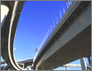
TURNER-FAIRBANK HIGHWAY RESEARCH CENTER
|
PUBLIC ROADS |
ARCHIVE |
Aftermath of the Kobe Earthquake
| Turner-Fairbank Highway Research Center |
Report about roads and bridges after the quake. |
|
TURNER-FAIRBANK HIGHWAY RESEARCH CENTER
|
PUBLIC ROADS |
ARCHIVE |
Lessons from the Kobe Quake
| Turner-Fairbank Highway Research Center |
Report about roads and bridges after the quake. |
|
WESTERN STATES SEISMIC POLICY COUNCIL (WSSPC) |
EARTHQUAKE RESOURCES |
Index of Kobe Images |
| Western States Seismic Policy Council |
40 thumbnail images of Kobe EQ |